We’d like to respond to the recent Plumas Sun article, “Unburned” by Jane Braxton Little about the US Forest Service’s so-called “Community Protection Project.” This article was also syndicated in Grist and Bay Nature.
Feather River Action! is one of three groups suing to require the USFS to prepare a full Environmental Impact Statement for this project.
We support many of the same things touted in the article—restoring fire to unburned forests and keeping communities safe. However, we are showing how there are better (and cheaper) ways to achieve those goals that don’t require destructive logging and damage to the forest (and local economies).
What did the Sun get right? Their article correctly states that fire rejuvenates forest ecosystems, and that the Forest Service has refused to provide key details to both journalists and community groups about the 400 square mile extreme logging plan.
But then it goes downhill fast. The article claims that the Forest Service has “held few public meetings.” In fact, the total number of meetings they have held with the public on this project has been zero, despite multiple requests. Our request for a correction has yet to be acted on.
Regardless of the journalist’s position (and it’s quite clear that the Sun is supportive of the project), the reader is entitled to enough information about the litigation to reach their own conclusions. The blinders and omissions in this piece show a stunning lack of curiosity about trying to understand why environmental groups would challenge a project that claims to be good for the environment and that they think is so great. In fact, it appears they went out of their way to avoid discussing anything substantive about our criticism (and we provided extensive evidence).
Here is a list of problems with the article:
1.) Omitted who is suing: We had to send multiple e-mails over several days and complain to the article’s funder, March Conservation Fund, just to get the record corrected that Feather River Action! was one of three groups (the other two, John Muir Project of Earth Island Institute and Plumas Forest Project, are not even mentioned in the article). Frankly, not even mentioning the groups’ names seems rather strange. In addition, the article makes no mention that the esteemed Stanford Environmental Law Clinic agreed to take the case. Surely that should be a relevant point, especially in an article of this length.
2. Silence on why we sued: As noted above, readers of this article should reasonably expect to learn the specifics of why environmental groups are challenging this project. But the author avoids getting into these specifics, even though this information was readily available. For example, note these three important points found on p. 7 of the objection we submitted to the USFS, based on what the USFS itself has stated:
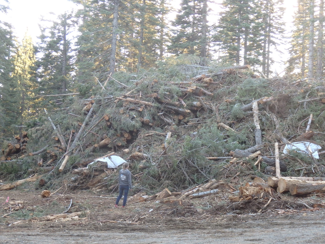
A. Thinning is not required before prescribed fire: The Forest Service admits, on p. 37 of their Response to Comments, that no tree removal is necessary prior to conducting prescribed fire, stating that “it is known that tree removal is not required before prescribed fire can be used.”
B. Thinning is 3-9 times more expensive: The EA also admits that mechanical thinning plus pile burning is 3 to 9 times more expensive per acre than prescribed burning.”
C. Most effective home fire safety measures dismissed as “outside scope of consideration”: When provided with multiple studies showing that the most effective way of protecting communities from wildfire is hardening and defensible space (not logging) the USFS responded: “Forest Service dismisses all evidence…. including Forest Service studies, about how to best protect communities from wildfire,” falsely claiming that it is “outside of the scope of the Forest Service’s consideration.” Remember, they literally called this project the “Community Protection Project.” Truly Orwellian.
2.) Avoiding critics of project: Jane wrote “nearly all of the 47 people interviewed argued that cutting procedural corners is justified.” So 47 people were interviewed, but apparently they didn’t interview any of the groups directly involved in challenging this project. Research assistants only talked to one of the three groups– Feather River Action!. Not interviewing John Muir Project’s director—Dr. Chad Hanson—meant that the Sun avoided talking with a scientist who has co-authored many studies and multiple books on forest fire ecology about his concerns with the project.
Not interviewing the Stanford Environmental Law Clinic’s director–Deborah Sivas–meant that the Sun avoided talking with one of the most experienced environmental attorneys in California about why she chose to take on this case. Somehow the author and her assistants found time to interview 46 other people, but couldn’t find time to talk to the lead plaintiff, the lead attorney, and any other critics of this type of project. The Plumas Sun say they are going to publish a follow up article about our lawsuit — we’ll wait to see how that turns out.
Most of these 46 people the Sun interviewed are active recipients of millions of US Forest Service dollars. It is not surprising, then that they would praise the project. Upton Sinclair said, “it is difficult to get a man to understand something, when his salary depends on his not understanding it.”
We are not going to get good outcomes by avoiding and omitting groups that are raising concerns about the Forest Service’s current approach. That’s not good journalism and it’s not good for our forests and communities.

3) Unethical and Shoddy Journalism:
The Plumas Sun claims to “distribute news that meets the highest standards of public service in journalism.”
We reviewed the ethical standards set out by the Society of Professional Journalists, and determined that the Sun violated more than a dozen of them in this article by selectively leaving out relevant and crucially important scientific studies and oversimplifying the narrative to support their own pre-conceptions.
This fails to meet the Sun’s stated goal of providing “fact-based, and unbiased coverage on matters of public interest and concern in the region.” This is not “trusted community coverage” but shameless propaganda, and we do not use that term lightly. The Sun claims that “accurate information is a cornerstone of democracy.” It’s pretty clear that both are under attack.
4) The article misrepresents what actually happened in the Dixie Fire
Ryan Bauer, formerly of the Forest Service, states that:
“Years earlier, U.S. Forest Service crews had removed the brush and smaller trees, reducing the most flammable vegetation. Then they set fires…When Dixie arrived, the same fire that melted cars and torched 800 homes hit this stand and dropped to the ground. Here Dixie was tame, a docile blaze meandering across the forest floor with only occasional licks up the trunks of trees…”
This is blatant misinformation, as anyone who witnessed the Dixie sweeping into town on Aug. 4th can attest.
Contrary to the idyllic picture painted by Mr. Bauer, the Dixie fire swept up from the southwest, moving rapidly northeast through vast areas that had been mechanically thinned, before destroying most of the towns of Greenville and Canyondam, along with the smaller town of Indian Falls. That is a fact. No doubt there was lower intensity fire in that area, but this was likely at night or during calmer weather.
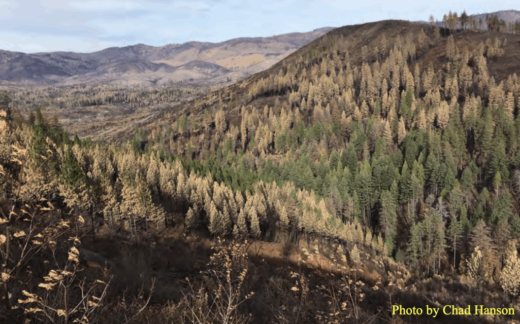
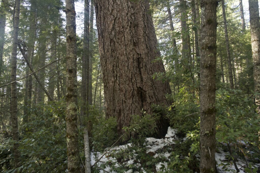
5) The article states that “the rest of the Plumas forest is still green but far too crowded, with trees six to seven times as dense as in the past, according to a 2022 study led by prominent fire scientist Malcolm North.” This study, which was actually funded by the Forest Service (which financially benefits from commercial logging on public lands), specifically calls for the killing and removal of 80% of the trees in the Sierra Nevada, a radical, arrogant, and deeply troubling proposal.
Turns out the methodology in the North study was faulty as well. More detailed investigations found that Forest Service scientists omitted most of the historical tree density data. When the omitted tree data were included, it turns out that historical forests had about 200 trees per acre, on average, with some areas much denser, and some less dense, but about the same as at present. This is undisputed by the Forest Service. The North study also failed to mention that most studies show that denser forests tend to burn at lower intensities on average!
6) Omitting crucial details, such as impacts on wildlife, widespread use of herbicides, and the importance of home hardening:
No mention is made of the fact that the Forest Service’s plan— according to their own estimates— will emit over 6 million tons of carbon, worsening extreme weather and wildfires, doing the reverse of what it claims.
The article states that “If the Plumas burns, the 8,000 people who live in towns like Quincy, Graeagle and Portola are in jeopardy.”
First of all, the Plumas National Forest has burned and will continue to burn. There’s no “if” about it. Fire is a natural phenomenon that has increased in intensity in the last few years due to hotter, drier, and windier climate conditions caused by human emissions. These towns are in jeopardy not because the forest around them has not been logged but because they have not done the structure hardening or defensible space necessary for safety in a wildfire prone area.
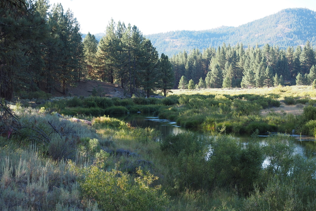
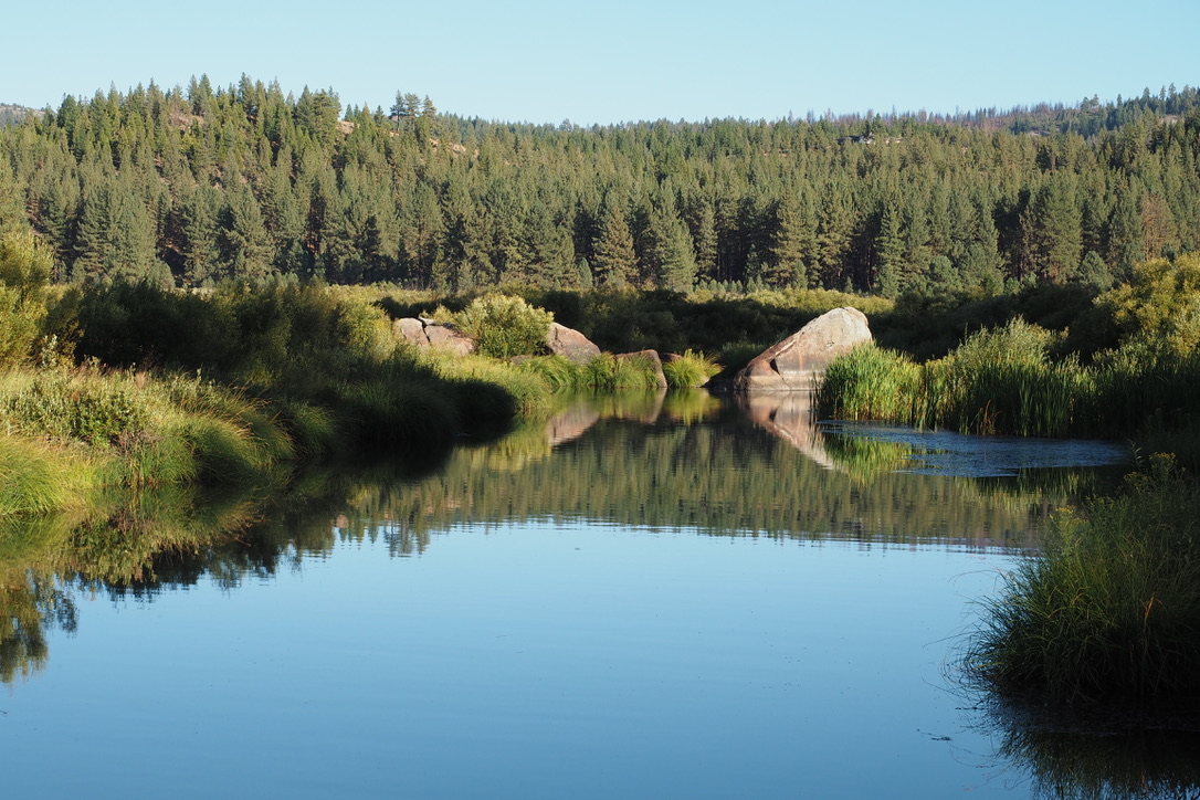
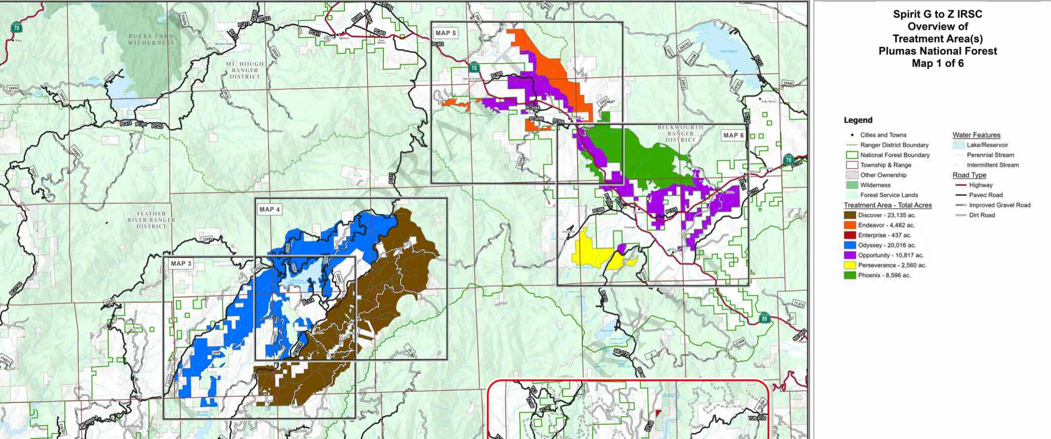
No mention is made in the article that the plan targets nearly 70,000 acres in the Strawberry Valley area, an old growth/ mature rainforest ecosystem up La Porte Rd. from Quincy. This is an area far from population centers, but rich in large mature trees that are more profitable to log. It is an area that loggers have been itching to exploit. After the major fires early in the decade, the timber industry realized they would be able to exploit these tragedies to justify logging in areas that were previously off limits. The Strawberry Valley area makes up the bulk of the emergency designation that fast tracked logging and bypassed any objections from the public.
No mention is made of the fact that 7 types of pesticides (including Imazapyr which is banned in the EU) are planned to be used to convert wild forest— in many cases nowhere near communities— to monoculture tree plantations.
You also wouldn’t know from the article that the Plumas County Board of Supervisors- as regressive as they are— filed an objection opposing the planned use of chemical herbicides as part of the project. This is critical information intentionally left out of this pie-in-the sky article.
No mention is made in the entire article about the importance of home hardening and defensible space, recognized as the only meaningful intervention to protect communities. This is simply a negligent oversight in an article about fire. In fact studies show that removal of trees or brush farther than 200 feet from structures has zero impact on structure survival in a wildfire (Syphard et al 2014). Home hardening and creation of defensible space is the most cost-effective intervention to prevent wildfire losses, according to experts.
The article fails to even mention species that may be impacted such as the CA spotted owl, whose population is plummeting primarily due to logging of old growth forests. The USFS unilaterally amended the Plumas Forest Plan (without adequate notification or public meetings) in order to log more heavily in known nesting and habitat areas.

The Plumas Sun ignored these facts. Likewise they do not address impacts to other species. One example is the mule deer, who keep their fawns safe underneath dense shrubby areas. Fawns are spotted to blend in with dappled sun under the shelter of shrubs and hide from predators. If the shrubs are poisoned and hacked out of existence, mother deer will have nowhere to hide their fawns, and they will be eaten by predators.
That, sadly, does not appear to be the top priority for the “Mule Deer Foundation” who received $14 million (to, in fact, degrade mule deer habitat). They are quoted in the Sun article as calling it a “once in a lifetime opportunity” (Is this an ‘opportunity’ to fund a new mansion, boat and safaris abroad, one might ask).
7) USFS has no legal requirement to do underburning so the forest will likely remain “unburned”
While the more profitable logging portion of plans is often completed, the less profitable (but essential) underburning is most often never carried out. The authors of the Unburned article believe that somehow this project will be different, describing the project as “visionary and ambitious.“ This is glowing, almost reverential language normally reserved for the opinion section. It’s jarring to read it as part of a supposed news article.
The ‘Community Destruction Project’ is indeed visionary— it’s a vision of a future of poisoned, dried out forests in a climate wrecked world, decimating and burning communities that have been starved of funding for defensible space so that logging companies and their investors can get rich destroying wild areas.
A Forest Service employee who asked to remain anonymous, told us:
“To be fair, underburning takes a lot of people, funding, and the exact conditions of wind, moisture, fuels, etc. So, yeah, it’s difficult to do. And no leader wants to risk a controlled burn getting out of control, I can’t blame them for that. But leaders just use that as an excuse to ignore the needed underburns….NEPA was done over the past 15 – 20 years, on thousands of acres across Beckwourth District that included underburning but the burns were never done. The line officers made decisions to ignore underburning and that should be exposed. They should be held accountable. They’ve all moved on to promotions.”
The Sun continues to refuse to publish letters-to-the-editor or opinion pieces from their readers (a service that is essential to any legitimate news outlet and that the Plumas News provided for years). How is this “empowering the public”? We appreciate much of their coverage, but any news source remains incomplete without the community weighing in.

In this era of political violence, we need more peaceful dialogue, not less.
Mountain community safety, and the integrity of local ecosystems depends on open debate, clear eyed and independent journalism, and avoidance of “groupthink” when making decisions. By writing one-sided articles, and denying the public a chance for feedback, the Plumas Sun is doing a disservice to public discourse and safety in our community. We await their follow up article, and will respond to any omissions or mischaracterizations on this site.