Sierra Groups Demand Halt to US Forest Service Spraying of Glyphosate and Other Toxic Herbicides in Public Forests

Herbicide Application on private lands along Hwy. 89 east of Canyondam June 6th, 2026 Photo: Feather River Action!

Locals Say NO to Conversion of Public Forests to “Privatized and Poisoned” Tree Plantations

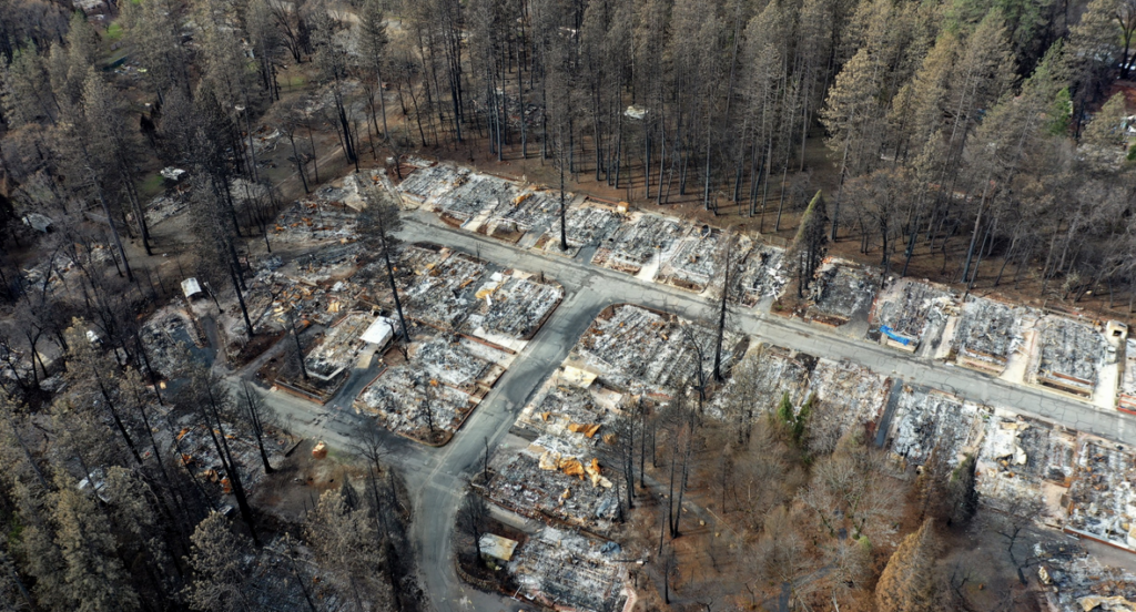
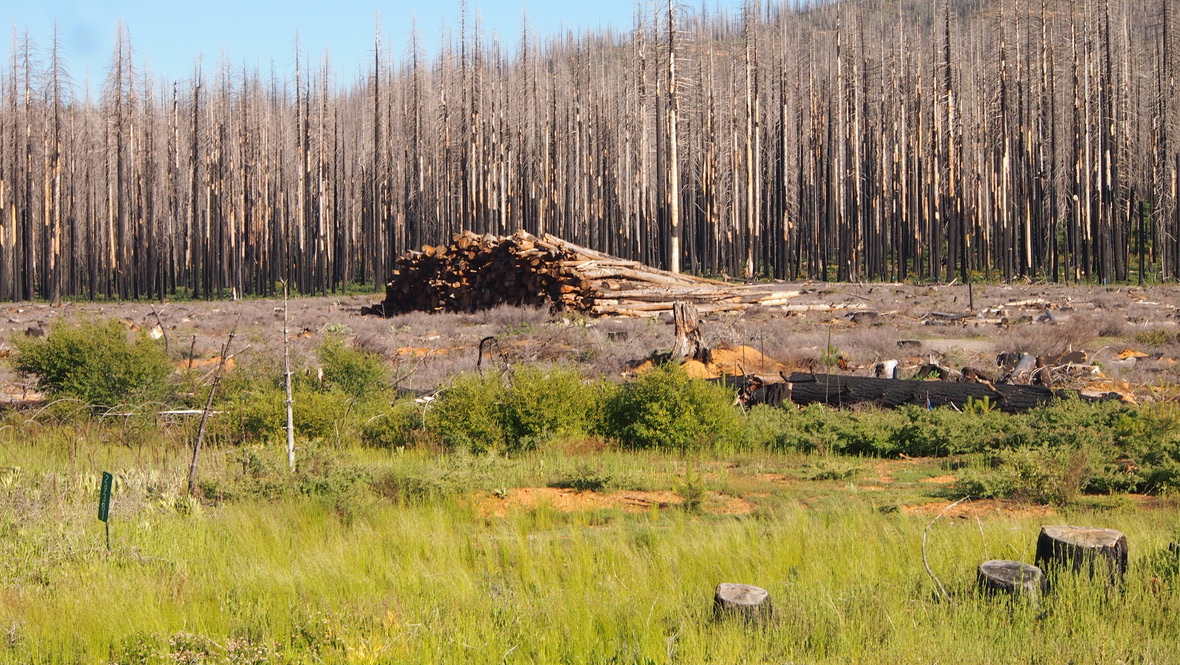
PORTOLA, CA— Recent reports in the national media, including in Mother Jones and on NPR Reveal, and in the local Mountain Messenger, have shed light on the U.S. Forest Service’s (USFS) vastly expanded glyphosate (and other herbicide) spraying on public forest lands. Now, new estimates for the quantity of spraying have been calculated using USFS documents, revealing plans to spray more than 104,224 acres (162 square miles) with more than 1.46 million pounds of carcinogenic herbicides. One of the largest of these plans– what the USFS calls the “Community Protection Project” — is being challenged in court by local groups including Feather River Action! and Plumas Forest Project. Residents, alarmed by the scale of deforestation and herbicide spraying planned for local watersheds, are demanding an immediate halt to all spraying in national forests.

Planted pine tree sprayed with glyphosate on Collins pine land west of Chester (Photo: FRA!)

Glyphosate herbicide is designated a “probable” carcinogen by the International Agency for Research on Cancer (IARC). Bayer, the manufacturer of “Roundup” and other chemicals, has been forced to pay more than $12 billion in personal injury settlements to victims of non-Hodgkin Lymphoma and other diseases.

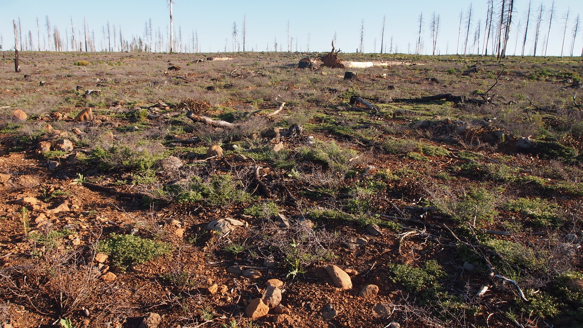
Despite the known health risks, and with little to no intervention from state regulators, Glyphosate and other chemicals are being sprayed on entire landscapes within the Feather River watershed, a source of drinking water for more than 23 million Californians. Satellite images show a huge “round up” scar on the north side of Lake Almanor, apparently resulting from extensive herbicide use on 140,000 acres of private timber production lands, belonging to Collins Pine, surrounding the town of Chester. Rough estimates are that over 1 million pounds of herbicides have already been sprayed on this land, part of the Lake Almanor watershed.


Collins Pine, which is “FSC Certified” and who owns the herbicide-devastated “Almanor Forest” seen in the map above, claims on their website to: “provide key habitat elements needed to support all native animal, plant and fish species.”

Now the U.S. Forest Service is poised to adopt the same intensive, herbicide dependent management practices on public land at a similar scale, without holding a single public meeting to address residents’ concerns.

Backed by only one (withdrawn) safety study, the USFS continues to recklessly push forward with plans to vastly expand its own herbicide spraying on public forest lands in the Northern Sierra, including near communities like Greenville, Lake Davis, Quincy, Cromberg, and Portola, as part of several projects claiming to “improve forest health.”

Herbicide treated scar visible from space- not great for clean water, carbon storage, wildlife… or recreation (photo: FRA!)

According to Feather River Action! “This is a secret plan by industry to undermine the multiple use mission of the Forest Service. Recreation, clean water, and habitat uses of the forest are being sacrificed for monocrop poisoned plantations that are less resilient to wildfire and would threaten local communities with fast moving wildfire. People spoke out strongly against recent plans to sell off US Forest Service lands and those plans were shelved. This is a de facto privatization and taking of public lands. Lacking specific information on sprayed areas, the public would not know where it is safe to recreate, and could avoid whole regions, with devastating consequences for local economies.

Extreme logging on public lands near Greenhorn, CA as part of the so-called “Community Protection Project”- USFS admits such mechanical “thinning”  will allow wildfires to move into communities faster. Photo: Plumas Forest Project

Local organizations Feather River Action!, Plumas Forest Project, as well as national group John Muir Project are suing the Forest Service in federal court to require the USFS to prepare a full Environmental Impact Statement (EIS) for the so-called “Community Protection Project Central and West Slope” (CPP) project, that includes areas in Plumas, Butte, Sierra, and Yuba counties. An EIS would be required to take a deeper look at impacts from heavy logging, mastication and herbicide spraying over such a wide area. The groups are represented by Deborah Sivas and the Stanford Environmental Law Clinic.

USFS plans to unleash industrial logging and herbicide “treatments” into areas along the Feather River including the Gooseneck, west of Portola, shown in August 2025 (FRA!)

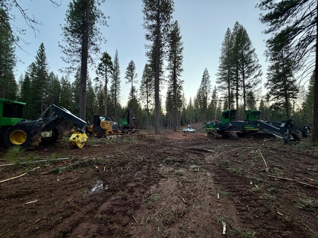
As part of the CPP project, the USFS is spending more than $674 million of public funds to industrially log and spray chemicals over a wide area (logging on 217,721 acres and spraying over 51,000 acres as part of the CPP project alone). Industrial deforestation north of Hwy 70 between Greenhorn and Blairsden has already started, and USFS contractors plan to expand as soon as June 2026 to areas near Portola and the ecologically sensitive Feather River “Gooseneck” area west of the city.

Map showing areas that USFS plan to spray in Plumas National Forest (in orange)

The largest and most pristine ecosystem under threat from tree plantation conversion is the area around Strawberry Valley, up La Porte Rd. from Quincy. It is the only rainforest in the Sierra, with 80+ inches of rain annually.

Strawberry Valley Rainforest Threatened by USFS Tree Plantation Plan (Photo: FRA!)
Heavy herbicide spraying (shown in orange on inset and on map above) is planned all along the boundary of Bucks Lake Wilderness, and private properties bordering federal lands.

Areas adjacent to the pristine Bucks Lake Wilderness near Quincy, CA are also planned to be heavily sprayed, according to Forest Service maps. The organization, Friends of Plumas Wilderness, did not respond to repeated e-mails seeking comment.

According to Feather River Action: “Areas of old growth and mature forest far from any community are being targeted with herbicides and industrial equipment as part of this so-called “emergency” action. Communities have been demanding public meetings with the USFS, but they have refused to hold even one, and bypassed environmental reviews normally prepared for a project of this scale. The threat posed by the secret herbicide spraying program is a direct result of the deregulation of USFS forest management programs.”

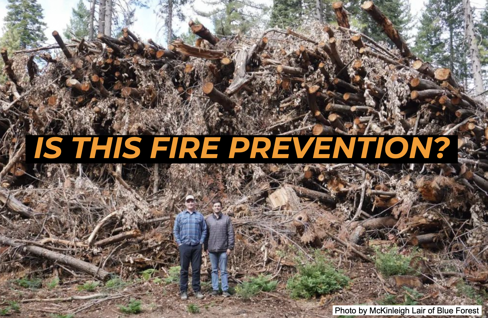
Local environmental groups say this goes to the heart of our failed wildfire safety strategy and timber industry corruption that’s led to public wildfire mitigation money paying for actions like “thinning” and spraying herbicides that would make forests and communities even more vulnerable to climate extremes. They refer to these projects as “wildfire excuse logging.”

These groups say that the projects would actually increase danger to nearby communities. They point to the CPP project, where the USFS withdrew the plan’s objective to reduce wildfire speed after the groups raised several scientific studies showing that thinning increases speeds during a wildfire. Instead of changing their project to actually slow down wildfires (and protect communities) the USFS simply dropped the objective. The speed of wildfires is strongly associated with structure losses and deaths.

There exists no independent scientific evidence that tree or brush removal farther than 100 ft. from structures has any impact on the survival of those structures in a wildfire. Despite this, 98+% of public funding is going to deforestation (including spraying)— often miles from communities. Meanwhile, less than 2% goes to home hardening, defensible space, and evacuation planning—the only proven ways to save lives and property.

Herbicides clearly being used above a stream within the area burned by the Dixie Fire–  NW of Greenville, CA. June 6th, 2026.(FRA!)

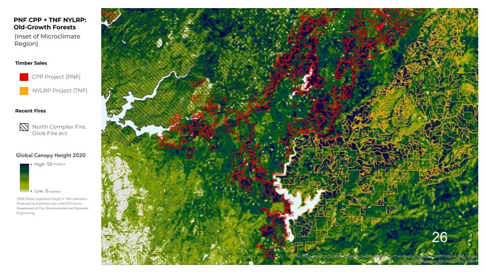
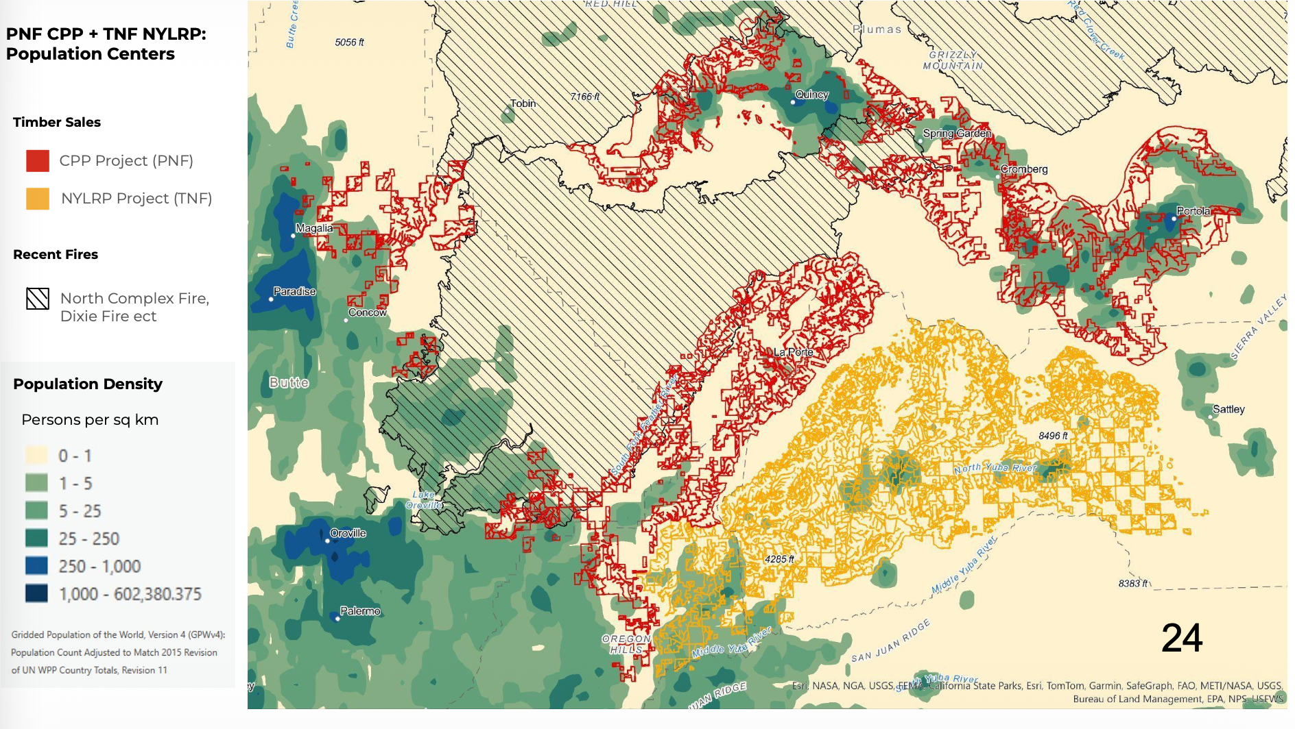
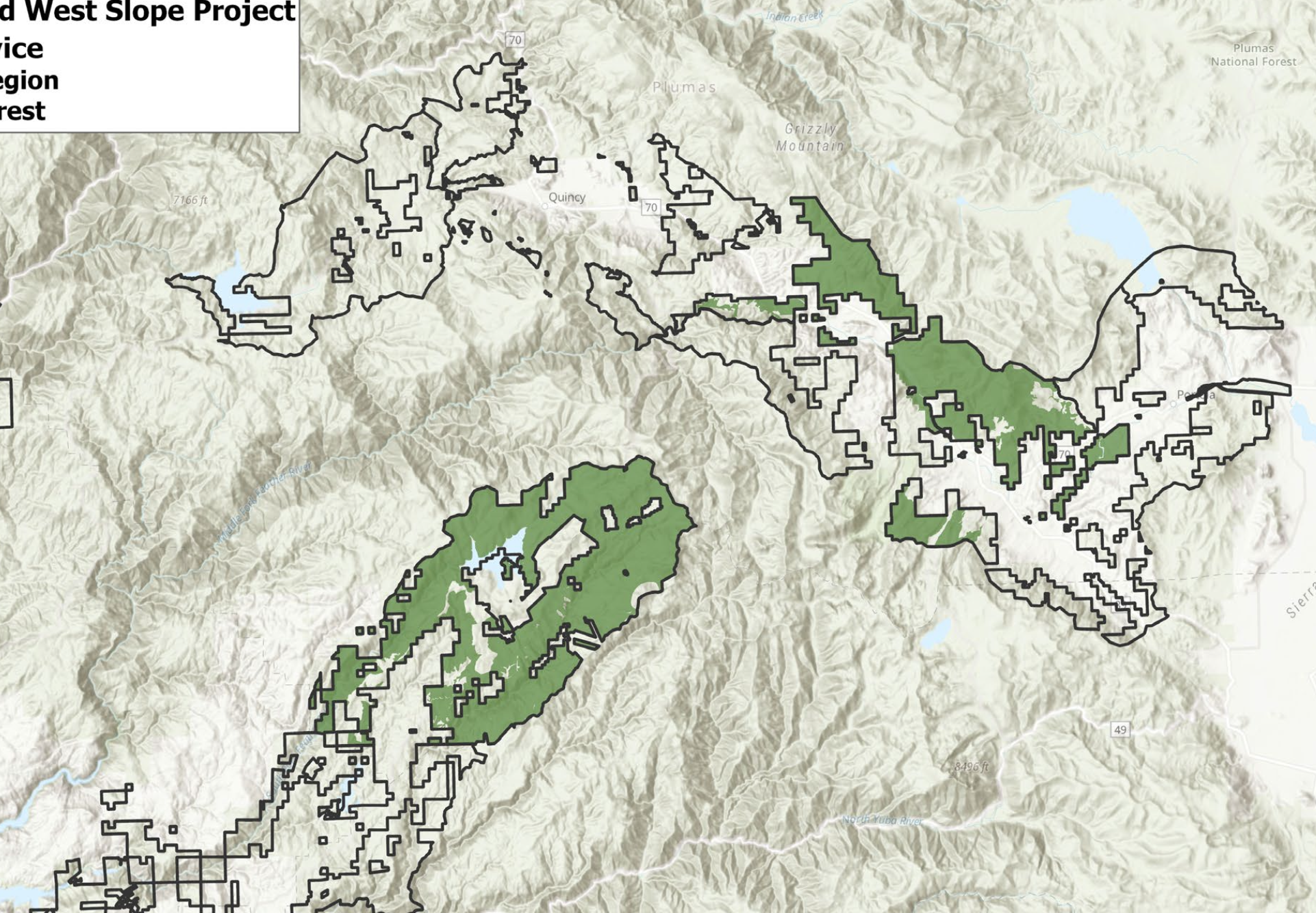
Here is a map of the CPP project, showing treatment areas along the Hwy. 70 corridor (near Quincy, Portola, Blairsden, Cromberg, etc.) and the areas to the west (in the Strawberry Valley area). Areas in green are “emergency” prioritized areas. They are apparently starting with the eastern portion.

USFS “Community Protection Project” –green areas are “emergency” logging areas

FRA! inquired with the USFS multiple times what the total quantity of herbicides planned to be applied in the area would be and they repeatedly refused to disclose this information. Nevertheless, FRA! calculated likely herbicide quantities for areas of the Plumas National Forest and these totals are available below, based US Forest Service public documents.

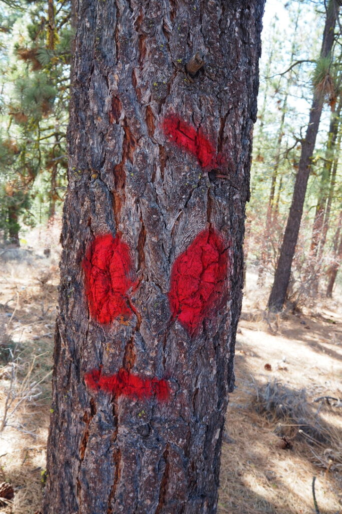
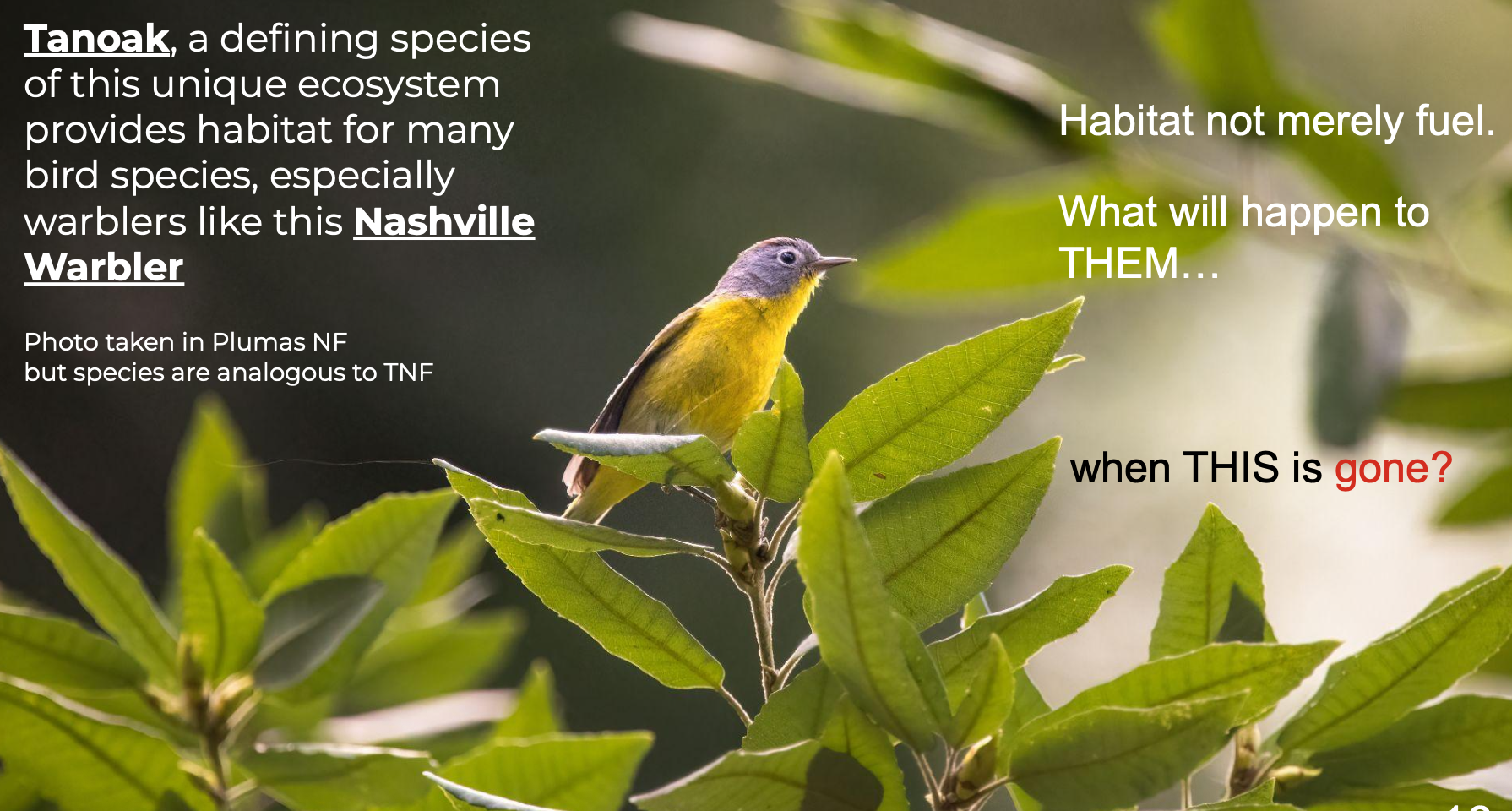
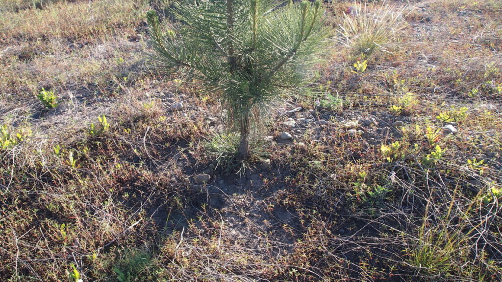
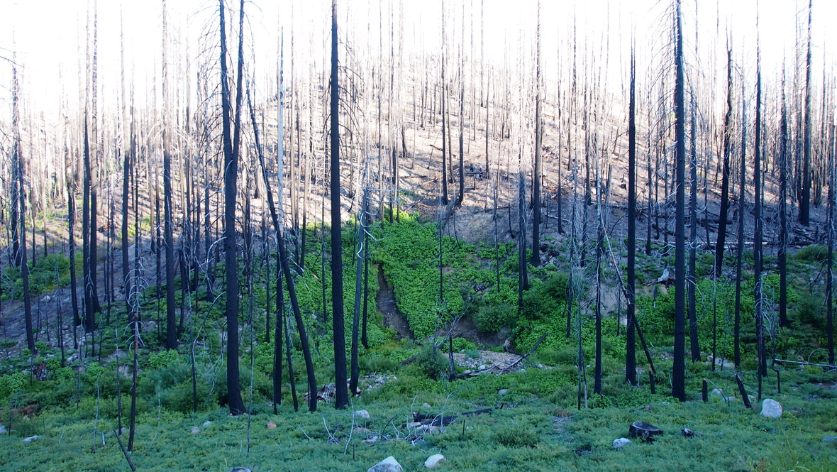
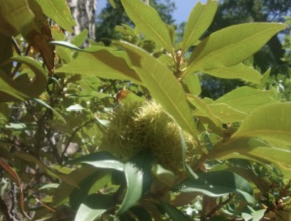
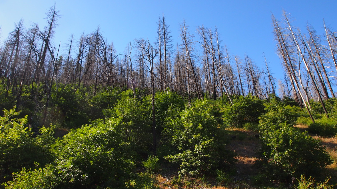
These are some of the native plant species they are targeting:

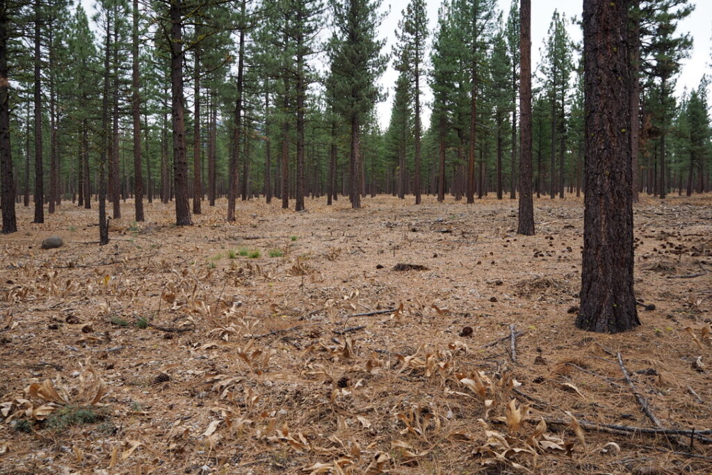
These are food for wildlife and necessary inhabitants of forests. They retain moisture and carbon. They should not be killed with toxic chemicals in the public forest for the timber industry to “reduce competition” for the tree crop.

Deerbrush


Bitter cherry


Deerbrush


Chinquapin


Manzanita

Here is a list of the herbicides U.S. Forest Service contractors plan to use (includes Imazapyr, a substance banned in the EU because of toxicity to humans and the environment):


Normal healthy forest 5-year post Dixie fire recovery without the use of bulldozers or herbicides, south of Crescent Mills along Highway 89 (Photo: FRA!)

List of “Restoration” Projects Active in Plumas National Forest (PNF)– (total project acreage / acreage to be sprayed with and est. amt. of herbicides:

Community Protection Central and West Slope (near La Porte, Quincy, Cromberg, Portola, etc.): 217,721 total acres / 51,000 acres to be sprayed with 714,000 lbs+

Community Protection Project Eastside (near Janesville, Milford and Doyle): 57,462 total acres / 6,800 acres to be sprayed with 95,200 lbs.+

Tributaries Project (north of Lake Davis, Genesee, etc): 163,248 total acres/ 19,550 acres to be sprayed with 273,700 lbs.+

North Fork Forest Recovery Project (near Greenville): 166,889 total acres/ 26,874 acres to be sprayed with 376,236 lbs.+

Area of PNF planned to be logged under current major plans:  438,599 acres (685 sq. mi.)

Total forest area to be sprayed:  104,224 acres (162 sq. mi.)

Total amount of herbicides planned to be used on the Plumas National Forest (estimated based on USFS documents showing up to 14 lb/ acre application rates in “reforestation areas”):  1.46 million lbs. (repeated applications not included– which could raise the total to ~14.6 million lbs. — this is the amount contained in nearly three olympic-sized swimming pools, for reference).

Logged and sprayed area in he midground near Canyondam June 6th, 2026 (Credit; FRA!)


TAKE ACTION- Who to Call and What to Say:

1. Contact Plumas Forest Supervsor Laura Schweitzer at 530-283-2050

2. Contact your Congressperson

3. Contact the Plumas County Board of Supervisors at (530) 283-6170 and pcbs@countyofplumas.com

4. Contact the Chief of the US Forest Service at tom.schultz@usda.gov

5. Contact Brooke Rollins U.S. Secretary of Agriculture at (202) 720-7100

6. Call US EPA: (202) 272-0167

7.   Call California Department of Pesticide Regulation: (916) 445-4300

8. Call EPA Region 9 Office (Western States) (415) 947-8000

9. Contact Federal Representatives: Rep. Kevin Kiley (CA District 3) (202) 225-2523  Senator Alex Padilla (CA) (202) 224-3553, Senator Adam Schiff (CA) (202) 224-3841

10. Contact Portola City Council: 530-832-4216 citymanager@cityofportola.com

Sample Comments:

Hello, my name is [YOUR NAME] and I am calling from [YOUR CITY/TOWN]. I am calling to express my strong opposition to the Forest Service’s plan to spray glyphosate herbicides across millions of acres of US Forest Service managed public forest lands.

I understand that the Plumas and nearby National Forests are currently coordinating several vegetation management and forest treatment projects that include the vastly expanded use of herbicides. Glyphosate is classified by the World Health Organization as “probably carcinogenic to humans.” California has listed it under Proposition 65 as known to cause cancer. The 9th Circuit Court vacated the EPA’s flawed safety determination in 2022.

This is not only an environmental issue — it is a direct threat to the health of families, children, and outdoor workers in our community. The Feather River — source of drinking water for 23 million Californians, cannot absorb more chemical stressors. The soil microbiome needed for real forest recovery would be destroyed.

I urge you to do whatever you can to immediately HALT any glyphosate spraying on public lands. Please pursue evidence-based wildfire safety measures such as structure hardening, defensible space pruning, and underburning around communities, NOT mechanical logging and poisoning of our watersheds! There are huge environmental and human health risks to such mass chemical applications.

There is zero evidence that killing of trees or brush farther than 100 ft. from structures affects structure survival in a wildfire.

Please record my strong opposition in the official record.

Thank you for your time.


Other actions you can take right now:

— Stay up to date with our e-mail newsletter- subscribe by sending us a brief request.

Donate to Feather River Action! so we can continue to do this type of reporting and litigation on critical environmental and public health issues.

— Volunteer by contacting us with your skills / how you can help.

— Follow us on Bluesky

Major Winter Heatwave Raises Stakes of Industrial Logging to Rural Communities

This winter was already the hottest on record for many places in the west…


The unprecedented spring heatwave in the southwest is about to get a lot worse, decimating already feeble sierra snow pack, and setting up Northern California mountain communities for a possibly severe fire season, making discussions and debates about community fire defense even more urgent.

Next Friday March 20th— the last day of what was once referred to as “winter.” — it’s predicted to hit 83F in Portola at 5000 feet elevation and 94F in Redding. Highs should stay in the eighties for several days.

Check out weather & climate expert Daniel Swain’s recent discussion of this likely record breaking (and lethal) heatwave. I can always gauge how bad the situation is by his tone, and he is visibly shaken and alarmed by these worsening climate developments.

A weasel, in the snowy environment such a coat evolved to blend in with..

A few days ago, I saw a weasel scurrying across a green and brown wetland meadow near the Feather River. Her coat was white, evolved over thousands of years of late winter snowpacks to blend in with and escape predators. Now, against the bare earth, and green plants, she stood out from the landscape, and she seemed to realize it, seeking out a pile of rocks with urgent curiosity. Like weasels, humans are also struggling to adapt to higher temperatures, especially at this time of year. We are all waking up and squinting to the new reality of living on a planet spinning faster and faster into truly dangerous territory.

I’d like to say government and quasi-government agencies are responding sensibly to this emergency: slashing emissions, setting aside forests, wetlands, and the moisture and carbon they lock up on the landscape, anything to throw the brakes on the climate freight train heading straight at us. I’d like to say we were urgently assisting (especially vulnerable) people to harden their homes and communities so loss of life is prevented during inevitable wildfires.

But that is sadly not the case.

Instead, the US Forest Service, CalFire, and other agencies have ramped up multi-billion dollar extreme logging plans in some of the wildest, remotest old growth forest remaining in the Sierra, pledging to kill and remove nearly 80% of the trees across vast swathes of wild lands, in the name of “forest management” and “forest resiliency”— using falsified data of past forest density to justify such an extreme intervention, while largely leaving rural communities to deal with the consequences.

We know from (actual science) that allowing the powerful evaporative effects of sun and wind into a forest canopy that is broken apart by heavy machinery disrupts the forest’s natural resilience, putting both forest communities and human communities at risk from droughts, floods, and storms, also dramatically increasing wildfire spread rates.

Homes burned in Paradise. Note living trees surrounding. If these homes had been hardened, using money that USFS paid to thin surrounding forest (that the fire raced through into town), they would still be there, and many fewer souls would have perished.

Greenville, Paradise, and other communities have already dealt with the consequences and false promises of thinning near their communities. How many more?

The USFS in particular is planning so many timber extraction projects on public land within and around the Plumas National Forest, it is hard to keep up (but we are trying!). These include:

— So-called “Community Protection” Project Central and West Slope (~218,000 acres)
— So-called “Community Protection” Project Eastside Project (~58,000 acres)
North Forks (~167,000 acres)
Tributaries (~163,000 acres)
North Yuba Landscape Resilience Project (275,000 acres)

Total: ~881,000 acres (~ 1377 square miles!) For reference this is just over half the land area of Plumas County, and well over the total area of the state of Rhode Island.

Since the USFS has not provided a single map of these projects to help the public and decision makers understand the true overall impact, we thought it would be a good idea to make our own. If you gave mapping/ GIS skills and want to help us with this project, or are able to carry out forest surveys, please reach out!

Trees marked to designate private land boundaries in preparation for landscape level logging.

By what is known as “piecemealing” one massive overarching plan to log the Sierra Nevada into separate projects, the Forest Service is attempting to obscure the scale of the impact of their overall logging plan on wildfire, community safety, climate, water quality, and survival of threatened species such as the California Spotted Owl.

Other non-governmental and quasi- governmental groups in the area are moving forward with their own logging plans, many of which are not undergoing any environmental review whatsoever.  Many of these groups receive direct funding from the Forest Service and other (timber-industry captured) agencies.

We don’t know what the Plumas Fire Safe Council has in mind with their “East Quincy Fire Project” because they have not replied to our repeated inquiries, likely due to our criticism of one of their projects in Eastern Plumas.

Likely what the “Fire Safe Council” is planning for East Quincy. Be Wary.

We suspect it is this failed approach they are pursuing, with heavy equipment set to damage the greenbelt in the name of “community safety.” Instead of improving fire safety, this kind of project instead sets up a disaster scenario where wildfires speed through thinned areas and slash piles into communities intentionally left unprotected by spending public money on logging instead of home defense.

I hope I am wrong. I hope the the Fire Safe Council is following best practices and scientific advice and prioritizing what science tells us are the most effective interventions: home hardening, pruning and defensible space around structures. If they want to go beyond that, perhaps respectful underburning (not pile burning which harms the land) and hand thinning of smaller trees in the immediate region around communities to aid fire defense would be appropriate.

We hope that is the case, but without additional information, we just have to assume the worst at this point.

If you want to find out more about this project, you may want to write to the Plumas Fire Safe Council and ask some simple questions:

— Will their project increase moisture in nearby forests, or decrease it?

— Will their project increase or decrease the spread rate of inevitable wildfire during high wind events?

— Will the project assist in providing defensible space and home hardening to the people of E. Quincy?

— What actual scientific evidence are they relying on that shows logging or brush removal farther than 200 ft. from structures has ANY EFFECT on the survival of those structures?

— What environmental (eg. CEQA/ NEPA) review is being carried out?

Please let us know if you hear back. I don’t see how continuing to refuse to provide information to the community (about projects that we pay for) is anything like a sustainable strategy for these groups.

Otherwise you can attend their meeting on Tuesday March 17th from 5-6pm and ask them in person.

Our mountain communities are made of kindling. Ember intrusion, ignition, and subsequent house to house spread— even as surrounding trees stay green and healthy— this is the biggest single cause of structure loss during a wildfire. 

Wildfire– even high intensity wildfire–  is a natural cycle, necessary for healthy forests. Though it may look devastating, the patchwork created by variable intensity wildfire is crucial for diverse habitat, and has been for millions of years.

Large logging equipment destroying a wild forest near Greenhorn, Plumas County, California
Recent intensive logging in Greenhorn is set to spread across the region, with wildfire as the excuse.

Hacking away at vegetation in the forest in the name of fuel reduction may give some people a sense of control, and make quite a bit of money for some, but the reality is the embers don’t care a bit when they burn up the abandoned slash piles and send even more embers up to 2-3 miles from a flaming front, igniting a tinderbox community.

The results of all this are as predictable as they are preventable. If we funnel limited resources away from actual community hardening, and believe the lie that logging bare entire forests will prevent wildfire intrusion into communities, more people will die. It’s as simple as that.

And those who swallow and perpetuate the lie, because it’s easier than asking the tough questions and accepting that we may have gotten some things wrong, will have blood on their hands when their “forest management” results in wildfires speeding into communities, denying inhabitants time to evacuate.

Every public dollar flowing to “forest management” is a dollar that is not available for critical community hardening work. And it is making it much harder for animals like the weasel, who need shelter and habitat more than ever, but are finding it increasingly difficult to find it among the thinned tree plantations being created.

It’s a choice being made with your hard earned money— whether to respond effectively to climate collapse, or double down on the corporate corruption that led us to this place, waiving forest protections when we need them the most.

There’s a better way, and it starts at the home. Let’s unite around what really works to save lives and property, and not be misled by those who seek to hijack a true emergency to line their own pockets.

Sign saying "protect and enjoy your national forest"

What the Forest Service Doesn’t Want You to Know: Fire Pretense Logging in the Northern Sierra Targets Unique Old Growth Rainforest Ecology Critical to Climate


As large machines continue to devastate the forest around Greenhorn, near Quincy, CA, part of the Forest Service’s “Community Protection Project,” we thought it would be a good opportunity to consider what is at stake if industrial logging and herbicide spraying spreads across 400 square miles of the most sensitive and carbon rich habitats in the Sierra, as planned.

Last year, Sierra Forest Action!  a grassroots forest defense league based out of Grass Valley, created a presentation about the North Yuba Landscape “Resilience” Project in the Tahoe Forest that includes mapping and analysis of the Plumas Forest’s “Community Protection Project.” This is a meticulously detailed and informative presentation, a rallying cry to save these vanishing habitats critical to climate security, and is essential viewing for anyone who wants to go beyond the deceptive narrative of “hazardous fuels.”

You can download the presentation here in pdf format:

Sierra Forest Action! Presentation on CPP and NYLRP

Contrary to Forest Service claims (that logging in old growth and mature areas in being phased out) this logging appears to intentionally focus on the most remote, oldest and carbon/ moisture/ biodiversity-rich areas:

Map showing overlap between USFS planned logging (red outline) and old growth areas marked in dark green on base map (using canopy height as a proxy)

Pay special attention to slide 26 (above), this shows an overlap between Mature and Old Growth forest conditions (MOG, the darker green) and where logging is planned (red and yellow outlines). There is a very close overlap between canopy height, indicating MOG areas, and planned industrial removal of 77% of the forest canopy.

Map of Population Centers and Fire Pretense Logging in the Northern Sierra:


As you can see from the map above, it is not brush clearing and pruning around communities they are planning (as the name Community Protection Project would imply). This is extreme industrial logging in the most wild, sensitive, ancient, rare and ecologically valuable areas in the Sierra.

The priority “emergency” logging areas around La Porte (the southern area marked in red) and containing the largest trees, has been fast-tracked for heavy logging, and is largely nowhere near population centers (marked in green and blue), apparently having little to do with “community protection” and everything to do with using fears of a climate/ wildfire crisis to justify even more aggressive logging.

The La Porte area is a remnant of when the planet’s climate (and continental interiors particularly) were wetter in the past, and it has many characteristics of coastal forests. These lower elevation areas on the western slope with dense, ancient, moist forest, lack the protections of higher elevation areas, and are directly threatened with logging, most likely starting spring 2026, unless the lawsuit that FRA is a plaintiff in, is successful.

Loss of this, one of the last wild, ancient forests in California, would mean a devastating loss of unique animals, plants, and trees, together making up a carbon bomb into the air of 6 million tons (according to USFS own stats). It’s also the state’s primary watershed, supplying 26 million with drinking water. If the forest is disrupted so dramatically, so is well spaced water flow and water retention through droughts. This is truly the last thing we need right now.

Don’t drink the kool-aid. This is devastation — not restoration.

Logging has always made wildfires riskier for communities in the west, from 19th and 20th centuries when most fire-resistant ancient trees, the matriarchs of the forest, were felled. The tradition continues today, but with an Orwellian twist.

The U.S. Forest Service’s industrial extraction projects masquerading as fire safety are neither “protective” of communities nor do they make forests more “resilient.”

Preservation of wild, dense, healthy, forested areas are critical to avoiding the most catastrophic climate outcomes and are thus of regional, as well as global significance.

Please spread the word about what is being done and protect these magnificent forests, California’s hidden — but critical — remnants of biodiversity and vast carbon stores that these projects would damage and release, to our common detriment.

Help prevent this from becoming a reality:

1) Subscribe to our e-mail updates (and get friends to do the same!). Send a blank e-mail to featherriveraction-subscribe@lists.riseup.net from the e-mail you wish to subscribe.

2) Make a donation to our legal and outreach efforts. It’s quick and easy!

3) Plan a visit to one of the areas impacted by “forest management” threats. Send us your pics and observations and we will post them on our website.

4) Follow us on Bluesky and Youtube.

5) Prepare to defend the forest.

Satellite view of logging in the Tahoe National Forest
Old growth area of Plumas National Forest near La Porte targeted by “Protection Project”